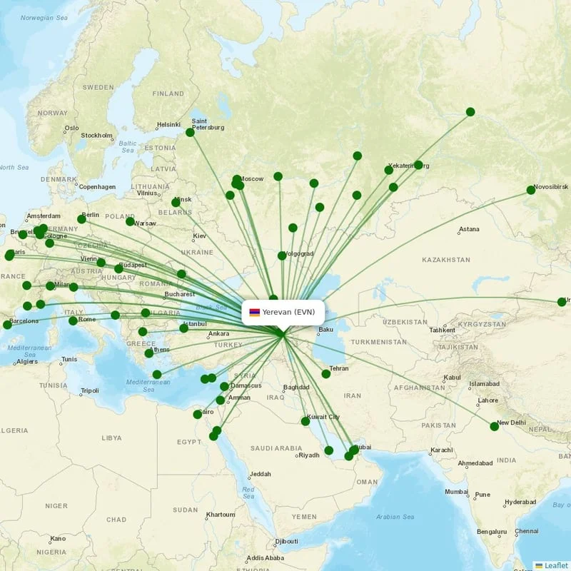
IATA CodeEVN
ICAO CodeUDYZ
CountryArmenia Armenia
Aerial view of Zvartnots International Airport (EVN) in Yerevan

Yerevan, Armenia

Location

UTC

Timezone

40.1489 N, 44.3979 E

Coordinates

2,838 ft (865 m)

Elevation

Loading flights...

What is Zvartnots International Airport?

Zvartnots International Airport (EVN/UDYZ) is Large Airport serving Yerevan in Armenia. Located at coordinates 40.1489 N, 44.3979 E, the airport sits at an elevation of 2,838 feet (865 meters) above sea level. Operating in the UTC timezone, the airport offers scheduled commercial flights to various destinations.

Current Weather

20°C
Clear
Clear

Feels Like 20°C

Humidity46%
Wind7 km/h
Visibility10 km

Local Time

21:44:25

Wednesday, June 3, 2026

Timezone Information

Local Timezone
UTC
Region: Armenia
Continent: Asia
Related Keywords
  • zvartnots international airport
  • zvartnots international airport iata code
  • evn airport
  • flights to evn
  • udyz airport
  • yerevan airport
  • yerevan airport iata code
  • yerevan flights
  • armenia airports
  • ugee
  • erevan airport
  • erivan airport

Where is Zvartnots International Airport on Map?

View the exact location of Zvartnots International Airport on the interactive map below.

Geographic Information

HemisphereNorthern Hemisphere
ContinentAsia
CountryArmenia Armenia (AM)
CityYerevan
Latitude40.148941
Longitude44.397887
Coordinates40.148941° N, 44.397887° E
Elevation2,838 ft (865 m)
GPS CodeUDYZ
Region CodeAM-ER

Location Map

Map of Zvartnots International Airport

Runways at Zvartnots International Airport

Zvartnots International Airport has 2 runway(s). Below you can find detailed information about each runway including dimensions and surface type.

08/26
Primary
Length
3,850 m12,631 ft
Width
56 m184 ft
Surface
Asphalt
08/26
Runway 2
Length
3,850 m12,631 ft
Width
56 m184 ft
Surface
Asphalt

Terminals at Zvartnots International Airport

Zvartnots International Airport has 2 terminal(s). Below you can find the list of terminals and buildings at this airport.

Zvartnots Airport
Zvartnots Cargo Terminal

Radio Frequencies at Zvartnots International Airport

Communication frequencies for pilots and aviation personnel at Zvartnots International Airport. These frequencies are used for air traffic control, ground operations, and airport information services.

TypeFrequencyDescription
APP126.000 MHzYEREVAN APP
ATIS119.500 MHzATIS
GND119.000 MHzYEREVAN GND
TWR128.000 MHzYEREVAN TWR
Zvartnots International Airport

About Zvartnots International Airport

Zvartnots International Airport is located near Zvartnots, 15 km (9.3 mi) west of Yerevan, the capital city of Armenia. It acts as the main international airport of Armenia and is Yerevan's main international transport hub. It is the busiest airport in the country as well as the 13th-busiest airport in the post-Soviet states.

Read more on Wikipedia

Airport Analysis for Zvartnots International Airport

Category
Large airport
Airport classification type
Altitude
Medium
2,838 ft (865 m)
Service Status
Scheduled Flights Available
Regular scheduled flights operate at this airport
Direction Compass
NorthEast
Hemisphere position
Continent
Asia
Geographic region
Coordinate Position
Northern Hemisphere, Eastern Meridian
Geographic coordinate information

Nearby Cities to Zvartnots International Airport

Explore cities in Armenia that are easily accessible from Zvartnots International Airport. Discover nearby destinations with estimated driving distances and times.

Arbat’Armavir Region
1 km1 min drive
ArevashatArmavir Region
2 km2 min drive
MusalerrArmavir Region
2 km2 min drive
GhukasavanArarat Province
3 km3 min drive
HayanistArarat Province
3 km3 min drive
GeghanistArmavir Region
3 km3 min drive
Ptghunk’Armavir Region
3 km3 min drive
MerdzavanArmavir Region
4 km4 min drive
ArgavandYerevan
4 km4 min drive
DarakertArarat Province
5 km5 min drive
DashtavanArarat Province
5 km5 min drive
AygekArmavir Region
5 km5 min drive
NizamiArarat Province
6 km6 min drive
Norabats’Ararat Province
6 km6 min drive
ZorakArarat Province
6 km6 min drive
BaghramyanArmavir Region
6 km6 min drive
VoskehatArmavir Region
6 km6 min drive
HovtashatArarat Province
7 km7 min drive
NorakertArmavir Region
7 km7 min drive
Sayat’-NovaArarat Province
8 km8 min drive
MasisArarat Province
9 km9 min drive

Closest States to Zvartnots International Airport

Explore nearby states in Armenia accessible from Zvartnots International Airport. Plan your regional travel with distance information.

YerevanER
11 km3 airports
Aragatsotn RegionAG
21 km20 cities
Armavir RegionAV
31 km1 airports
Ararat ProvinceAR
38 km1 airports
Kotayk RegionKT
54 km1 airports
Gegharkunik ProvinceGR
66 km2 airports
Vayots Dzor RegionVD
91 km1 airports
Lori RegionLO
92 km1 airports
Shirak RegionSH
103 km1 airports
Tavush RegionTV
114 km1 airports
Syunik ProvinceSU
180 km4 airports

Reviews & Ratings

Share your experience at Zvartnots International Airport

No reviews yet. Be the first to review this airport!

Frequently Asked Questions

The IATA code for Zvartnots International Airport is EVN. The ICAO code is UDYZ. These codes are used by airlines, travel agencies, and passengers to identify the airport in booking systems.
Where is Zvartnots International Airport located?
Zvartnots International Airport is located in Yerevan, Armenia. The airport's coordinates are 40.1489 N, 44.3979 E.
What is the timezone at Zvartnots International Airport?
Zvartnots International Airport operates in the UTC timezone.
What is the elevation of Zvartnots International Airport?
Zvartnots International Airport is located at an elevation of 2,838 feet (865 meters) above sea level.