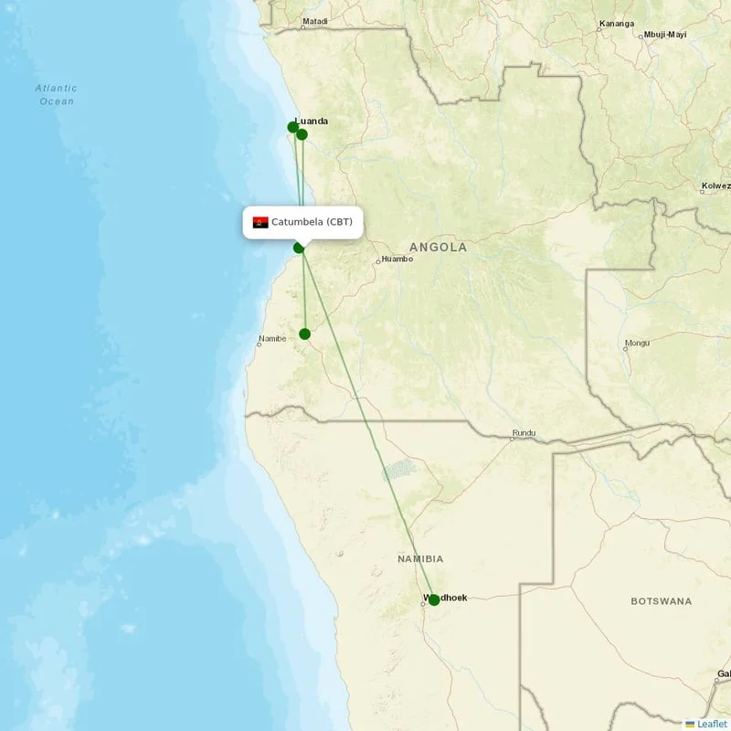
IATA CodeCBT
ICAO CodeFNCT
CountryAngola Angola
Aerial view of Catumbela Airport (CBT) in Catumbela

Catumbela, Angola

Location

UTC

Timezone

-12.4792 S, 13.4869 E

Coordinates

23 ft (7 m)

Elevation

Loading flights...

What is Catumbela Airport?

Catumbela Airport (CBT/FNCT) is Medium Airport serving Catumbela in Angola. Located at coordinates 12.4792 S, 13.4869 E, the airport sits at an elevation of 23 feet (7 meters) above sea level. Operating in the UTC timezone, the airport offers scheduled commercial flights to various destinations.

Current Weather

21°C
Clear
Clear

Feels Like 16°C

Humidity85%
Wind5 km/h
Visibility10 km

Local Time

22:52:50

Wednesday, June 3, 2026

Timezone Information

Local Timezone
UTC
Region: Angola
Continent: Africa
Related Keywords
  • catumbela airport
  • catumbela airport iata code
  • cbt airport
  • flights to cbt
  • fnct airport
  • catumbela flights
  • angola airports

Where is Catumbela Airport on Map?

View the exact location of Catumbela Airport on the interactive map below.

Geographic Information

HemisphereSouthern Hemisphere
ContinentAfrica
CountryAngola Angola (AO)
CityCatumbela
Latitude-12.4792
Longitude13.4869
Coordinates12.4792° S, 13.4869° E
Elevation23 ft (7 m)
GPS CodeFNCT
Region CodeAO-BGU

Location Map

Map of Catumbela Airport

Runways at Catumbela Airport

Catumbela Airport has 2 runway(s). Below you can find detailed information about each runway including dimensions and surface type.

02/20
Primary
Length
3,700 m12,139 ft
Width
44 m144 ft
Surface
Asphalt
02/20
Runway 2
Length
3,700 m12,139 ft
Width
44 m144 ft
Surface
Asphalt

Terminals at Catumbela Airport

Catumbela Airport has 2 terminal(s). Below you can find the list of terminals and buildings at this airport.

Aeroporto Internacional da Catumbela
Aeroporto Militar da Catumbela
Catumbela Airport

About Catumbela Airport

Catumbela Airport is an airport in Catumbela, a coastal city in the Benguela Province of Angola.

Read more on Wikipedia

Airport Analysis for Catumbela Airport

Category
Medium airport
Airport classification type
Altitude
Low
23 ft (7 m)
Service Status
Scheduled Flights Available
Regular scheduled flights operate at this airport
Direction Compass
SouthEast
Hemisphere position
Continent
Africa
Geographic region
Coordinate Position
Southern Hemisphere, Eastern Meridian
Geographic coordinate information

Nearby Airports to Catumbela Airport

Explore other airports located within a 300km radius of Catumbela Airport. This can help you find alternative travel options or nearby facilities.

Nearby Cities to Catumbela Airport

Explore cities in Angola that are easily accessible from Catumbela Airport. Discover nearby destinations with estimated driving distances and times.

CatumbelaBenguela Province
8 km8 min drive
BenguelaBenguela Province
14 km14 min drive
LobitoBenguela Province
14 km14 min drive
SumbeCuanza Sul
147 km2 h 27 m drive
QuilenguesHuíla Province
171 km2 h 51 m drive
CaluquembeHuíla Province
196 km3 h 16 m drive
LongonjoHuambo Province
197 km3 h 17 m drive
ChelaHuambo Province
212 km3 h 32 m drive
Uacu CungoCuanza Sul
217 km3 h 37 m drive
CacondaHuíla Province
221 km3 h 41 m drive
CaálaHuambo Province
229 km3 h 49 m drive
HuamboHuambo Province
247 km4 h 7 m drive
QuibalaCuanza Sul
253 km4 h 13 m drive
ChicombaHuíla Province
260 km4 h 20 m drive
LubangoHuíla Province
271 km4 h 31 m drive
ChipindoHuíla Province
288 km4 h 48 m drive
HumpataHuíla Province
289 km4 h 49 m drive
ChibiaHuíla Province
310 km5 h 10 m drive
QuipungoHuíla Province
316 km5 h 16 m drive
MatalaHuíla Province
357 km5 h 57 m drive
JambaHuíla Province
359 km5 h 59 m drive

Closest States to Catumbela Airport

Explore nearby states in Angola accessible from Catumbela Airport. Plan your regional travel with distance information.

Benguela ProvinceBGU
59 km8 airports
Huambo ProvinceHUA
229 km6 airports
Cuanza SulCUS
296 km5 airports
Huíla ProvinceHUI
300 km7 airports
Bengo ProvinceBGO
376 km2 airports
Cuanza Norte ProvinceCNO
382 km3 airports
Luanda ProvinceLUA
384 km5 airports
Bié ProvinceBIE
454 km8 airports
Malanje ProvinceMAL
476 km3 airports
Cunene ProvinceCNN
511 km7 airports
Uíge ProvinceUIG
626 km6 airports
Zaire ProvinceZAI
658 km6 airports
Major Airports in Angola

Discover other major airports in Angola. Compare distances and explore alternative departure points for your travel plans.

Reviews & Ratings

Share your experience at Catumbela Airport

No reviews yet. Be the first to review this airport!

Frequently Asked Questions

The IATA code for Catumbela Airport is CBT. The ICAO code is FNCT. These codes are used by airlines, travel agencies, and passengers to identify the airport in booking systems.
Where is Catumbela Airport located?
Catumbela Airport is located in Catumbela, Angola. The airport's coordinates are -12.4792 S, 13.4869 E.
What is the timezone at Catumbela Airport?
Catumbela Airport operates in the UTC timezone.
What is the elevation of Catumbela Airport?
Catumbela Airport is located at an elevation of 23 feet (7 meters) above sea level.